
Trace a Huntington Park Street
Address-first work is the reliable way to read a Huntington Park street. The address trail can connect a normalized postal address to a county parcel identifier, then to a recorded transfer or a city file. It cannot turn a property record into a household roster. Ownership, occupancy, mailing, and situs are separate facts.
- Normalize the address. Check the number, street spelling, unit, postal city, and ZIP against current delivery data. ZIP 90255 is principal, but a postal label does not settle the city boundary.
- Open the Assessor Portal. Search by street address or ten-digit AIN, then save the AIN, situs, and legal description before changing screens.
- Browse the parcel map. Center the highlighted polygon, click adjoining parcels one at a time, and record each AIN and situs as you pan along the street.
- Reach the latest deed. Use the parcel facts to target the RR/CC real-estate index, read the newest conveyance, and follow its grantor backward as a prior grantee.
- Add city records. Request Planning/Building files by address or APN for permits, Building Cards, inspections, certificates of occupancy, entitlements, and code cases.
- Use voter access correctly. The county status form confirms a submitted record with identity fields. It is not a public street browse, and full files require a qualified purpose and signed declaration.
- Check older address sources. Ask library reference staff about reverse or criss-cross directories, keeping the local year range unverified until a catalog record or volume confirms it.
Huntington Park Street Directory Records
Huntington Park is incorporated, but the largest property, deed, election, and court systems are countywide. The address record sets below show which custodian answers which street question, and where an online lookup ends.
| Address-Keyed Source | Record Keeper | Street Evidence | Access Boundary |
|---|---|---|---|
| Assessor roll | LA County Assessor | AIN, situs, legal description, values, use and building facts | Free address/AIN portal |
| Parcel map | LA County Assessor | Polygon sequence, adjacent AINs, geographic relationship | Free visual Map Search; no public buffer export |
| Deeds, liens and maps | LA County RR/CC | Named parties, document dates, legal descriptions and transfers | Office viewing plus online, fax or mail copy requests |
| Planning and Building files | Huntington Park | Applicants, owners, agents, project address, inspections and approvals | Address/APN request; no verified public lookup |
| City archive | Huntington Park | Applicants, speakers, payees, parcel addresses and civic context | Category, keyword and date search with PDF access |
| Voter status or file | LA County Elections | Submitted status or qualified-purpose voter data | Identity-gated status; full files are restricted |
| Reverse directory | Library reference collections | Historical address-to-householder or block sequence | Catalog and staff check; local years unverified |
The address index becomes more reliable when the AIN and legal description travel with each row. A street name joins the records in appearance, but the parcel identifier and legal land description keep similarly named streets, rear parcels, and multiunit sites from being merged.
Huntington Park Street Search Fields
The Los Angeles County Assessor Portal is the first named search point for a Huntington Park address. It accepts a street address or ten-digit AIN, not an open owner-name key. Its visible controls matter because a name-first search is not an available public route.
| Field Label | Type | Required | Format Notes |
|---|---|---|---|
| Search by AIN or Address | Autocomplete text | Yes | Ten-digit AIN or street address; owner name is not offered as the public key |
| Basic Search | Tab or button | No | Address and AIN mode |
| Legal Search | Tab or button | No | Legal-description-oriented search |
| Map Search / Assessor Internet | Tabs | No | Switch map and legacy property presentation |
The sample LA County parcel detail shows the kind of assessor view used after an address match.
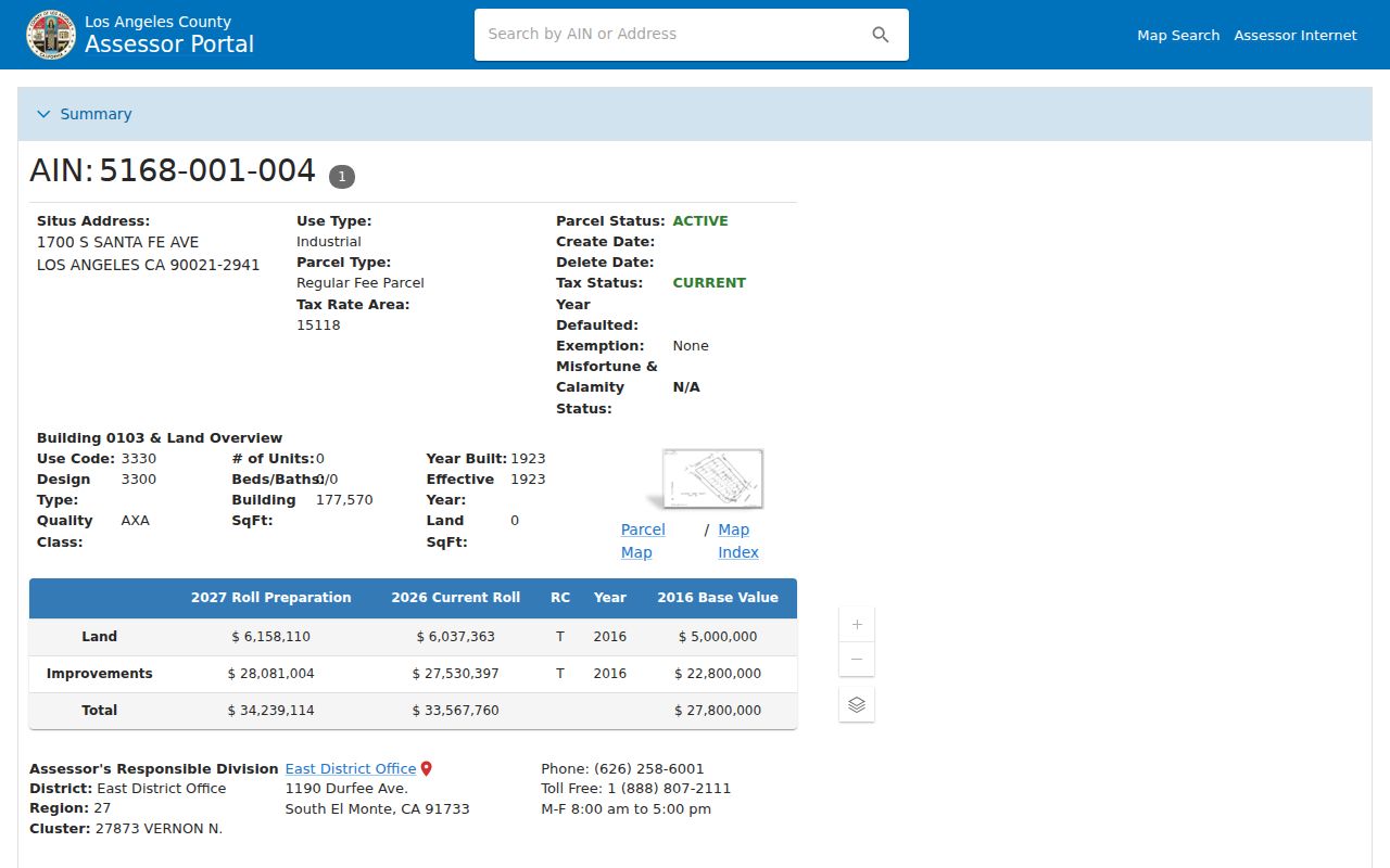
A parcel detail can show situs, AIN, legal description, tax-rate area, current land and improvement values, use and building characteristics, map position, and an effective date. Treat those facts as parcel evidence. They do not prove that the owner occupies the site.
Browse Huntington Park Street Parcels
Map Search is a visual street-browse tool. Enter the address or AIN, zoom to the highlighted polygon, and click the parcel beside it. Continue across the street and along the block, saving each AIN and situs separately.
There is no documented public radius or buffer export. That matters in dense Huntington Park blocks, where rear parcels and multiunit sites can sit behind a familiar street number. Pan in a controlled sequence instead of treating the next number as the next parcel. Record the portal’s effective date because labels and layers can change.
INSIDER TIP. When a map relationship looks odd, compare the legal description and lot or block context before assuming a street-number error. The parcel map is a lead, not a household list.
Huntington Park Address Definitions
Address terms carry different weight in an address-based directory. The situs locates the parcel, while the mailing address tells the county where a tax notice is sent. A legal description is the stronger bridge when street names or numbers changed.
- Parcel
- A county land unit tied to an AIN and mapped boundaries; one site may include rear or multiunit parcels.
- Situs address
- The physical location assigned to the land, not a claim about who lives there.
- Mailing address
- The destination for tax correspondence; it may differ from the parcel’s physical location.
- Legal description
- The subdivision, lot, block, or related land description used to hold the property identity steady.
- Criss-cross directory
- An address-order reference that can place a historical householder or block sequence, subject to exact-year verification.
Keep these fields in separate notes. A mailing address is not situs, ownership is not occupancy, and neither field supplies a complete list of people at a street location.
Trace Huntington Park Deed Records
RR/CC indexes recorded documents and parties, not a ready-made street roster. Once the Assessor supplies the AIN, situs, and legal description, use the newest deed to identify the document number, recording date, type, grantor, grantee, and legal property description.
Follow the grantor backward as an earlier grantee while holding the same legal description. Deeds of trust, reconveyances, liens, notices, and maps add timeline anchors, but they do not establish a household. County record books begin in 1850. The public pages do not state an exact remote electronic index cutoff, so no cutoff year should be invented. There is no free remote grantor-grantee name index.
The RR/CC real-estate viewing instructions explain the county office route.
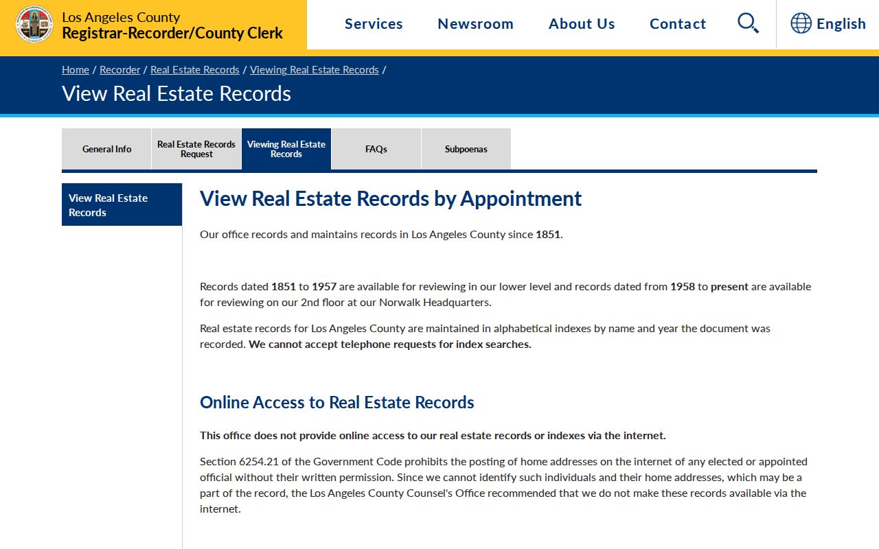
Real-estate records can be viewed at county offices, with online, fax, and mail copy channels documented by RR/CC. A normal index or order uses the document number, recording date, type, grantor, grantee, legal description or APN when indexed, and older book and page references. The consolidated office is 12400 Imperial Highway, Norwalk, California 90650. Call 800-201-8999, option 2 for recording or option 3 for post-recording real-estate records, or email recorder@rrcc.lacounty.gov. Check the current county page for copy charges.
Huntington Park Permits By Address
Planning and Building files add a different kind of street evidence. Request permit applications, Building Cards, inspection history, certificates of occupancy, planning entitlements, and code cases by address or APN. An applicant, owner, agent, and contractor can be different roles, so preserve the role named in each file.
The city has no verified public permit lookup. Use the counter, a records request, or the city’s forms and applications rather than assuming a search box exists.
The Huntington Park planning and permit forms show the city’s published request path.
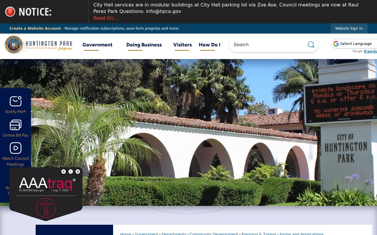
City Hall is listed at 6550 Miles Avenue, Huntington Park, California 90255, with published Monday through Thursday hours of 7:00 a.m. to 5:30 p.m. and closure Friday. A 2026 service notice places temporary modular buildings in the parking lot through Zoe Avenue, so verify the service location before travel. Approved entitlements are permanent under the retention schedule.
Huntington Park Archive Street Clues
The City Archive can add names and project context to a parcel trail. Its categories include council agendas and minutes, English and Spanish materials, newsletters, planning-related records, registers, and finance records. PDFs may name applicants, owners, agents, contractors, speakers, payees, and parcel addresses.
The Huntington Park City Archive offers category dropdowns, a keyword search, and start and end dates. Search a parcel address, project phrase, or person’s name, then read the attachment rather than relying on a result title.
A city archive result is civic evidence, not proof of residence. When a needed file is not online, describe an existing record series, date span, department, and address or project number in a request to the city custodian. Under the California Public Records Act, an agency normally determines disclosure within 10 days, with a possible 14-day extension in unusual circumstances.
Huntington Park Address History
Huntington Park’s street history can change the search terms. The land was part of Rancho San Antonio, then the Sunrise Tract. The early development was called La Park, while San Antonio Township and Los Angeles suburban descriptions may appear in older records.
Pacific Electric planning helped connect the Huntington Park name with a Randolph Street right-of-way in 1902. The post office retained La Park until incorporation in 1906. No official citywide street-renumbering year was located, so preserve the legal lot and block instead of assigning a date to a suspected change.
GEOGRAPHY. ZIP 90255, an assessor city label, and the incorporated boundary are different systems. Nearby unincorporated Walnut Park can share street continuity, but city permits depend on jurisdiction.
Huntington Park Reverse Directories
Reverse or criss-cross directories can hold an address still while names change around it. The exact Huntington Park year range is not verified. Ask LA County Library reference staff and the California State Library California History Room to check catalog records, title pages, and local shelf coverage.
The Huntington Park Library began in 1913, moved from City Hall in 1924 and 1931, and reached its Civic Center building in 1970. Search under Huntington Park, La Park, San Antonio Township, Rancho San Antonio, and Los Angeles suburban headings. Verify the publisher and abbreviation key before treating an entry as local evidence.
For the collection-level history of city directories, use the Huntington Park City Directories page. On a street project, keep only the address clue and return to deeds, permits, or a census snapshot for corroboration.
Huntington Park Voter Street Limits
The LA County voter status tool asks for last name, birthdate, house number, and ZIP. It confirms the requester’s submitted record. It does not let a stranger browse a Huntington Park street, and a voter file is not a household directory.
| Field Label | Type | Required | Format |
|---|---|---|---|
| Last Name | Text | Yes | Alphabetic only |
| Birthdate | Date or text | Yes | MM/DD/YYYY |
| House Number | Text | Yes | Numbers only; residence house number |
| Zip Code | Text | Yes | Numbers only |
| Submit or search control | Button | Not applicable | Verifies status |
Full voter files require a qualified purpose, signed declaration, and county request. Elections Code sections 2188 and 2194, plus Government Code section 7924.000, limit routine exposure of home street addresses, phone and email details, identifiers, signatures, and related fields. Participation can show whether a ballot was cast, never how a person voted.
MYTH. A ZIP and house number do not turn the county status form into a street search. Use the LA County status tool for an authorized confirmation, not a list-building exercise.
What Huntington Park Street Records Miss
A Huntington Park address search cannot show every person connected to a parcel. Household members who are not parties to a record may be absent. Utility customers and DMV address details are not substitute directories, and the federal Driver’s Privacy Protection Act limits motor-vehicle personal information.
Safe at Home participants receive additional protection under California law. A public map cannot establish who sleeps at a site, and an archive, deed, permit, or voter record should never be stretched past what its custodian says it proves.
Lawful personal use. Huntington Park records are for lawful personal research and family or property history. Protect withheld addresses and Safe at Home participants; stalking, harassment, threats, or intimidation are prohibited.
When a record appears wrong, return to the office that created it. The Assessor handles parcel corrections, RR/CC handles its recorded and voter channels, and Huntington Park handles its own planning and archive series.
Note: Address records become useful only when the parcel, source date, custodian, and lawful purpose stay linked through the search.